Featured

Time to go walking

IMG_9955I have lived on the Isle of Man for over thirty years and in that time have walked, cycled, run, climbed, dived, watched wildlife and studied the geology of this fantastic rock in the Irish Sea. Now, with slightly more time on my hands, I am making a point of going for a least one good walk each week in the relatively deserted upland of the island.

I have always been a bit of a ticker of lists and make no excuse for it. It can be a great way of making you get out and about and also to visit areas to which you wouldn’t otherwise go. I have climbed all of the Wainwrights in the Lake District, nearly 100 Munros in Scotland and compiled a list of Manx Summits over 300m, most of which I have climbed many times but first walked up all of them in a conscious effort in the Autumn of 2016.

Here is that list, all 33 of them!

List of summits

A few of the summits on this list unfortunately do not have any public access to their summits. This is something that DEFA should negotiate with land owners as a list of summits is one way of increasing tourism to the island with minimal impact on the wild environment.

This blog started as an account of walking up all the hills in my list but that is something I have done several times now. Instead it is now just occasional updates on the various routes I have taken whilst walking on Manx hills. I hope it inspires others to get out walking in the Manx countryside.

South Barrule from Glen Maye

IMG_4264

Unusually for me there was quite a bit of tarmac walking on today’s route but it was a beautiful day and quite nice to have the ease of walking on roads after some of the tracks early in the walk. From Glen Maye it would make more sense to go up Glen Rushen and then the Pipeline track straight to Round Table but I wanted to go up by the Doarlish Cashen (Sound Road) track as I hadn’t been that way for at least ten years. This meets the road near Easy Cushlin and if I had had the time I would have gone from there to the top of Cronk ny Arrey Laa and across Lanagor (sp?) to Round Table. As it was I walked up the road.

Starting outside the sadly abandoned Waterfall Hotel in Glen Maye I headed down the road and took the signposted footpath to the left next to a house. This narrow path led through an unusual ‘garden’ before becoming more obvious. Here I kept to the right to start the climb of the Doarlish Cashen track. In its lower part this is steep, narrow, wet (there had been very heavy rain the day before) and in places more like a rock climb up slippery slabs.

Nearer the top the track widens as it passes through fields but it doesn’t get any drier.

After a few gates there is a junction – the right of way goes to the right and is a first very wet, rutted and muddy. Eventually I reached the Manx Wildlife Trust ground where the track has been fenced in to stop motorbikes straying to either side. Unfortunately it was impossible to walk within the fenced area as it was so wet.

Once on the road South Barrule came into view and I plodded for 2km up to Round Table where I crossed the road, went through the gate and headed across the hillside to join the main path.

It was a fantastically clear day, perfect for this lovely hill. Chilly at the summit and even close to midday there were a few icy puddles in the shade.

IMG_2615

After my brief lunch I headed north, crossing the Iron Age fort wall and following the faint and wet track that at first heads towards Barrule Beg and then turns down aiming for the Cross Vein Mine on the other side of the main road.

After crossing the main road I followed the minor road past Cross Vein and then headed down Glen Rushen road.

Before heading down into Glen Rushen I took a walk around Beckwith’s Mine (Snuff the Wind). A fascinating place. As I have said before more needs to be done to preserve and cherish these reminders of the Island’s industrial past.

I then followed the rough road down through Glen Rushen, past the housing for the miners and all the way to where a footpath leads off to the left, down to a bridge.

This led back through the adopted garden and to the road and finally the car park.

Another lovely walk, challenging tracks, distant views from the hill and speedy walking on tarmac. 14km and 490m of ascent in 3hrs 30 min.


Slieau Whallian

IMG_4068

Last week I pottered up The Breary and Breary mountain by pretty much the same route as documented here before. Nothing new to report there except I did it in reverse, probably harder that way.

Just a short walk this week – following the simplest way to do a loop including the summit of Slieau Whallian. I parked on the back road just where there is access onto the old Foxdale railway line and a large lay-by and headed up the road to the gate at the bottom of the Green Way.

IMG_4053

I hadn’t been up this way for a while, it has always been rutted by run off from the fields but I was pleasantly surprised that it hadn’t got any worse though some fallen trees were in the way at one point.

IMG_4055

Near the top the views open up to Greeba Mountain to the north and South Barrule to the SE.

IMG_4056

This shot is from the Glen Needle reservoir where I should have turned right up a small track to follow the permissive access route but there is no way mark or sign and I continued through the gate to the next gate where I turned right along the path I had followed previously. I only realised this was the correct way later…

This climbs up through heather alongside a wall but at the top the gap int he wall had been fenced. There was a way through to the left under some barbed wire and I continued, presumably somewhere here rejoining the permissive path.

IMG_4061

At the start of the final slopes to the top there is a gate which I  had to climb.

At the top the views were a bit grey and misty and it started to rain but it is a very fine summit.

IMG_4070

From the top you need to take the right hand track northwards. This leads to a stile and then steep grassy slopes down to the boggy plateau above and the top of the plantation where there is a large cairn and fine views.

From here it is a short walk to the stile into the plantation where some rather old signs tell you where you are allowed to walk.


It is then just a case of finding the least muddy way through the top of the plantation and onto the fire tracks down to the road.

IMG_4083

5.6km and 340m of climbing in 1hr 30min.

Cronk ny Arrey Laa from Niarbyl via Lag ny Keeilley

A similar route to one I did last winter but without the inclusion of South Barrule. The coastal path south from Niarbyl is a very special part of the island and I followed it to White Beach, past the valley of Glion Mooar and all the way to the lonely Keeill and hermits cell at Lag ny Keeilley.

I then (foolishly, strongly not recommended!) headed straight up the hillside aiming for the summit of Cron ny Arrey Laa. I got there and had superb views from various precarious situations but won’t be repeating it.

Once onto the normal path from the Sloc I enjoyed dramatic views to the south.

IMG_3867

I continued to the top past where the views to the north opened up.

I took the way marked path down to Easy Cushlin and then down the side of Kerroodhoo plantation back to the White beach or Trail Vrish. This is a magical place and the light was dramatic.

I returned to Niarbyl, exhausted from my struggle up from the keeill, but very happy with the walk.

11km and 800m of ascent in 4 hours.


Slieau Lhost,Slieau Meayl and Slieau Ree

This covers more or less the same ground as a walk from last November but going the other way round and starting high at Windy Corner from where I quickly ascended the steep slope to the top of Slieau Lhost.

IMG_3553

The views form here are extensive over Douglas, the Baldwin valleys, Snaefell and Laxey.

IMG_3556IMG_3559

From here a clear track descends southward. It becomes boggy, heads east and then indistinct as you try to locate which of several mounds is the top of Slieau Meayl. It is the only one with a distinct cairn.

IMG_3568

At this point you are only just above Conrhenny plantation but sadly you don’t seem to be allowed to ascent from there. The views are excellent again.

IMG_3564IMG_3565

I retraced my steps westward and then continued in that direction, heather bashing to the gate onto the mountain road.

IMG_3569IMG_3573

Crossing straight over at Kepple Gate it was again a hunt for the highest bit of ground and the top of Slieau Ree, just a shoulder of the uplands rather than a distinct hill from this direction though from the south near Abbeylands it does look like a separate hill.

IMG_3575IMG_3576

I then tried to follow the footpath marked on maps heading NE below this hill but it is very indistinct and boggy. Eventually I reached a gate onto the more open hillsides below the mountain road and returned to Windy Corner.

IMG_3577IMG_3578IMG_3581

This walk is a bit of a struggle. Too much heather bashing for anyone’s liking but Slieau Lhost is a fine hill and Slieau Meayl gives interesting and surprising views.

9.5km with 250m of ascent in 2hr 30min.


Lhargee Ruy, Slieau Ruy and Greeba Mountain

A variation on an earlier walk, I parked near Greeba Castle and headed up into The King’s Forest.

IMG_3466

Following the main track up along the east side of the plantation I had a quick look at the old sluice gate before turning left and zig zagging upwards.

IMG_3468

Eventually I reached the top of the plantation and the open hillside.

From here I headed north at first then crossed the stream and headed east just above the wall, eventually reaching the Cronk Breck track at which point I headed uphill until reaching the fence and gate near the top of Lhargee Ruy.

Near here are a couple of cairns which give a fine view but the summit is actually a small rise on the featureless moor to the south.

IMG_3479

The route to Slieau Ruy is obvious from here. It is a lovely summit, fine views all around.

IMG_3483

Heading WSW at first then SW a faint track leads to the top of Greeba Mountain with it’s surprisingly large cairn (a tumulus?) and lovely views down into the central valley.

IMG_3491

Previously I have headed east from here to return to the stile at the top of the plantation but this time I wanted to explore the western side of King’s Forest and try to find the crags you see from the road so I went SW the S and discovered a gate at the corner of the plantation. I has to step over a broken fence but then found my self at the top of the crags.

I found a faint trail downwards and eventually picked up a mountain bike trail back to the bottom of the plantation.

I need to go back and explore the plantation some more but this was a great walk.

10km in 3 hours, 568m of ascent.

North Barrule from Ramsey Hairpin

North Barrule, Point 533, Beinn Rein, Clagh Ouyr, Point 336.

I started from the hairpin and headed up Elfin Glen. I followed the lower path, the upper one is more direct but not as scenic.

IMG_2066

The upper path is joined after a dip to a bridge crossing the stream and then a short reascent.

IMG_2068

Continuing up the track towards the Mountain Road North Barrule came into sight.

IMG_2070

On reaching the busy road I decided against walking up it to reach the stile and signpost at the picnic spot about 0.5km away and instead walked about 100m down the road and crossed to an old iron gate which gave access to fields around the tholtan of Park Mooar.

After having a look around the tholtan I continued straight towards North Barrule, crossing a ditch and then a fence via a broken stile.

It was then a slog up to the summit, not as entertaining as coming up through the rocks from Hibernian but it made a change from my usual route.

The wind was bitter and gale force along the ridge over Point 533 and Beinn Reins but the skies were for the most part clear.

After crossing the broken boards I climbed Clagh Ouyr.

I then immediately dropped north to Mountain Box and East Mountain Gate where I followed the fence to the head of the northern branch of Glen Auldyn before another search for the true top of Point 336, somewhere near the two pools.

IMG_2100

I then followed the track east through the heather and mud before dropping into Glen Auldyn just below the Black Pool.

IMG_2104

I then walked down the glen and took the Crossags path back to the hairpin.

16km and 587m in 4 hours.


Lhiatte ny Beinnee

IMG_1369

Lhiatte ny Beinnee is the reason my list of hills is those over 300m rather than over 1000ft. At 988ft but 301m this fine hill wouldn’t have made it in to the list otherwise.

I decided to climb it from sea level, Fleshwick Bay being a stunning location for a start.

IMG_1367

From the small car park area I crossed a small bridge and climbed steeply along the Raad  ny Foillan, keeping towards the cliffs where possible. The views back to Bradda Head and the Calf were stunning in the winter sun.

10753715024_IMG_228610752492528_IMG_229210752701136_IMG_2298

10752797952_IMG_229310752797568_IMG_2299

IMG_1368

10752562288_IMG_2308

There are various paths to the right which lead to the many cairns on the south easter side of the hill, I kept to the left but decided to visit some of these on the way back.

10752719632_IMG_2305

The top of the hill is flat moorland dropping steeply to the sea on the west.

10753683552_IMG_2336

I was soon at the cairn where I sheltered in it’s lee. The view north to last week’s walk over Cronk ny Arrey Laa and South Barrule was clear and dramatic.

IMG_136910753715312_IMG_2369IMG_1370

The sensible thing to do from here is to follow the path over Gob ny Beinn and descend steeply to the Slock and then follow the greenway back towards Surby. I wandered over the top of the hill visiting a series of quartz cairns before picking up the greenway.

10753725504_IMG_2378

IMG_1371

This track turns into a lane past some houses. Once in Surby I kept straight on down to a lane to pick up ‘The Rocky Road’ and followed this back to Fleshwick and the car.


So there we go, a short walk of just under 8km in two hours bring to the end this little project with all 33 hills climb again. There may well be more posts form walks On Manx Hills as and when I find other interesting ways up them but maybe not as regularly.

Get out and climb some hills!

Cronk Ny Arrey Laa, South Barrule and Dalby Mountain

10756901216_IMG_2230

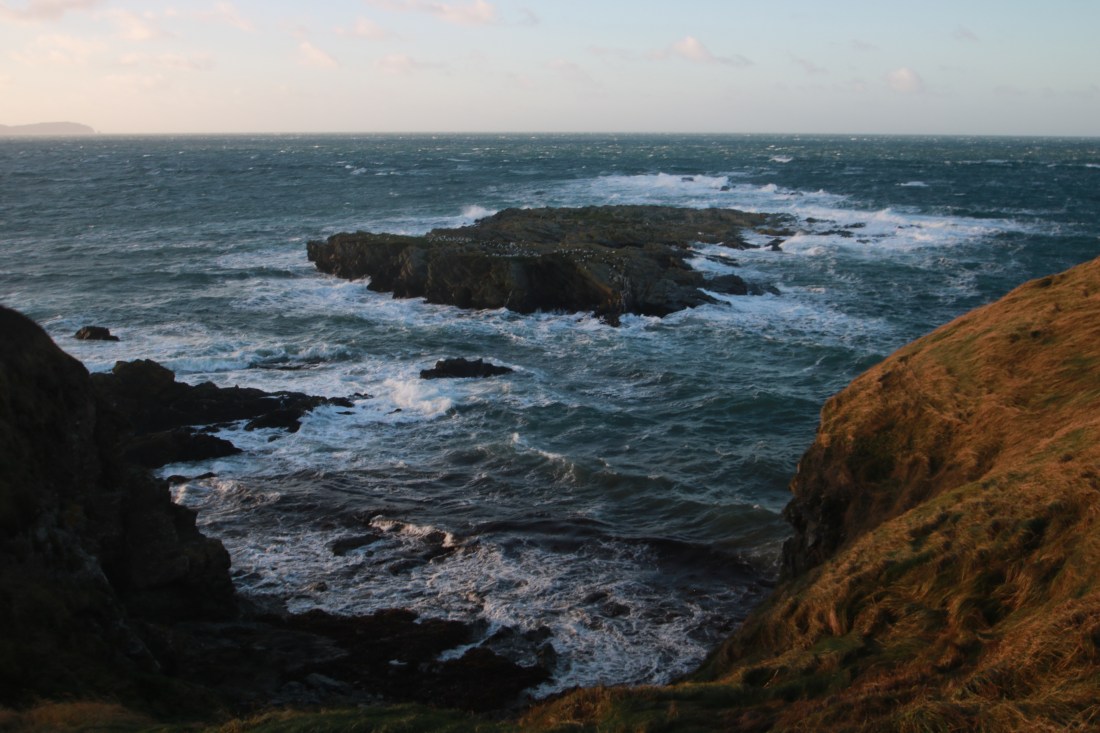
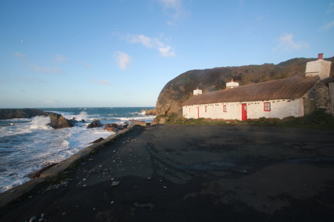
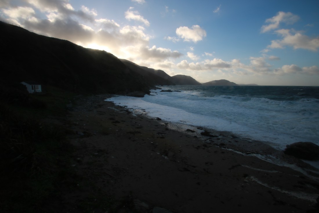
A magnificent walk in the South of the Island on a dry but very windy day when the boats were again cancelled. I decided to make a big day of these hills by starting at Niarbyl, parking in the cafe car park and walking down to the beach where the combination of high tide and a gale was filling the air with foam.

10757076912_IMG_214510757624224_IMG_2153

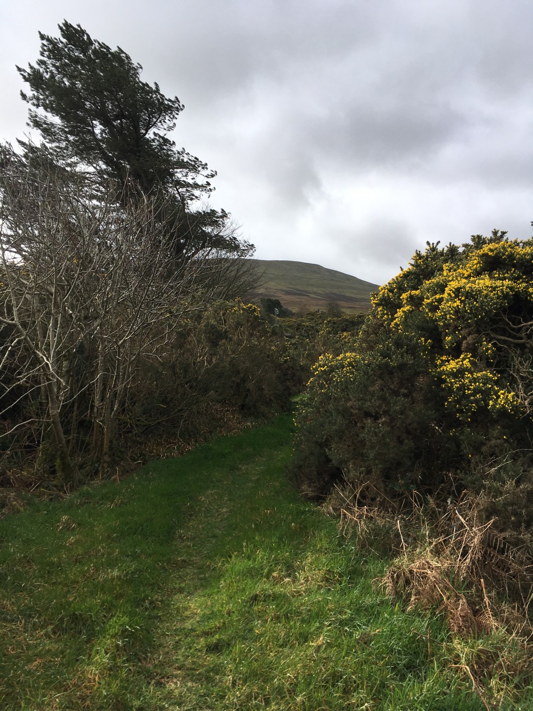
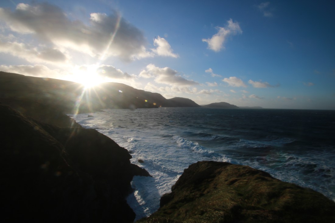
I set off on the coastal path towards White Beach, the wind making going hard but the views of the rough sea were superb.

10757057312_IMG_216110756901648_IMG_216810756741936_IMG_2155

10757654496_IMG_2172

10756743328_IMG_2174

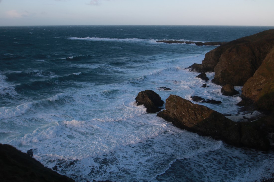
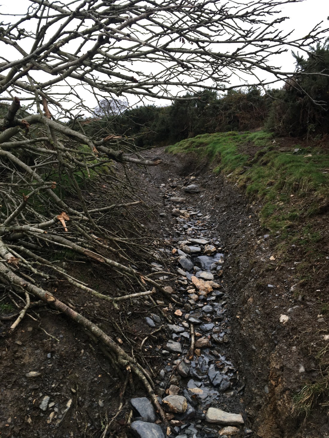
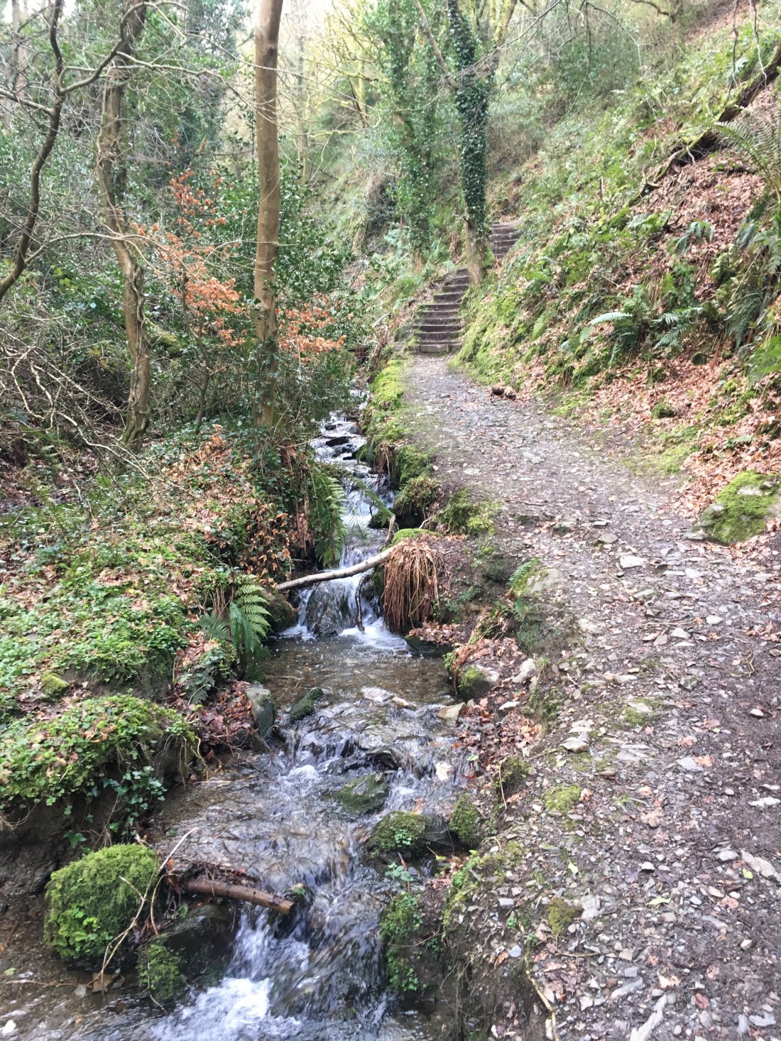
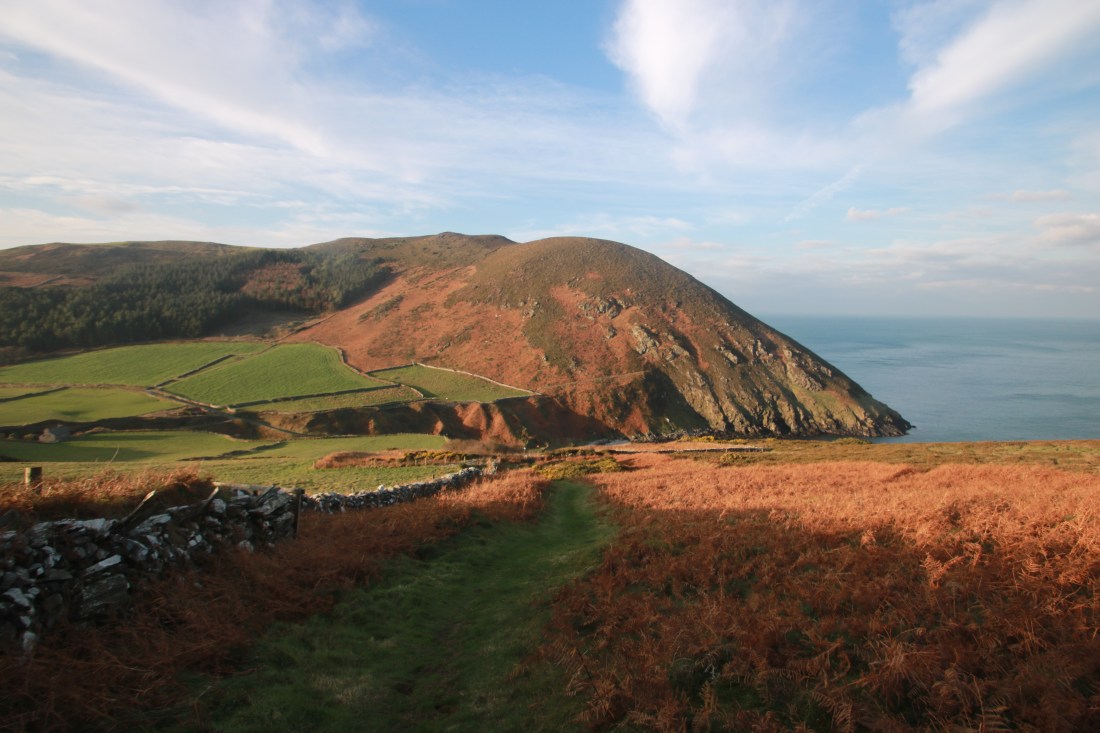
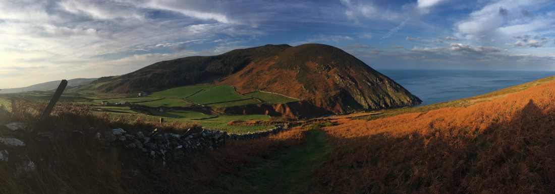
I descended back to sea level at White Beach, the tide was in so there wasn’t much room to cross the stream below the beach waterfall.

10756980432_IMG_217810756777536_IMG_217910757605440_IMG_218010757608032_IMG_218410757622736_IMG_219310757645408_IMG_2186

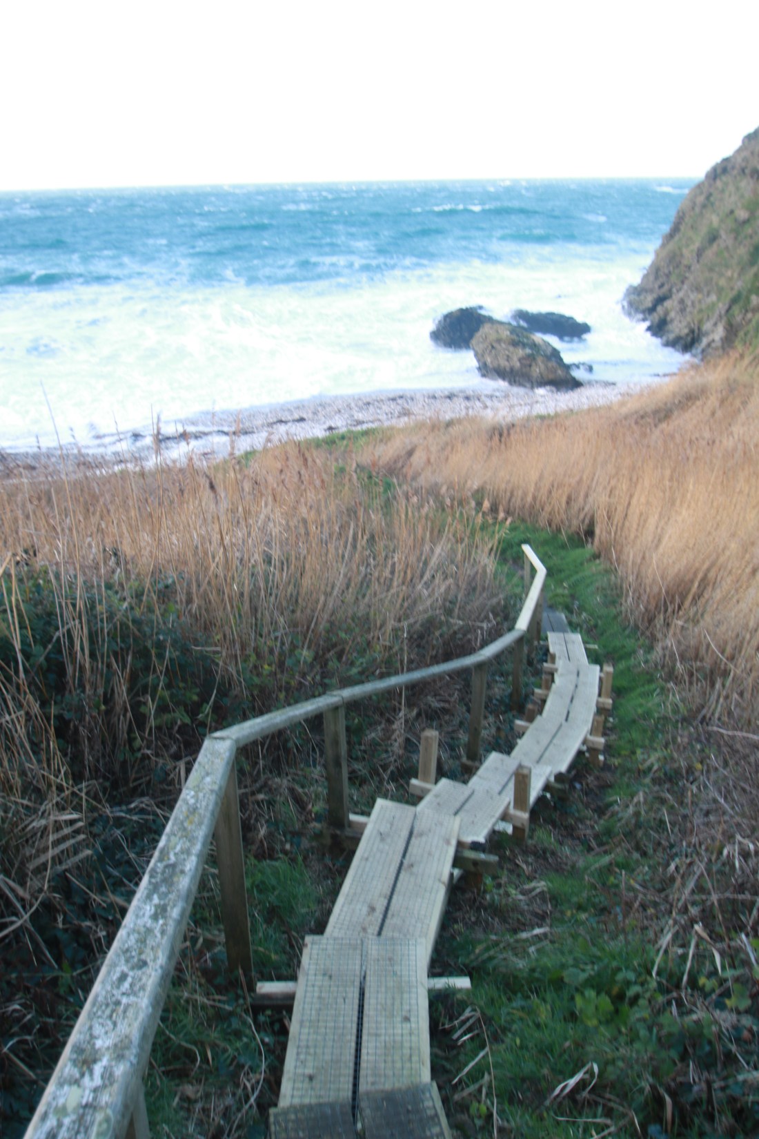
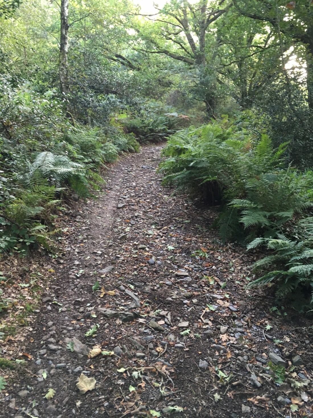
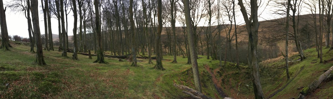
Just past the stream I took the path up behind the beach hut and at the top continued straight on rather than up the main track which is private.

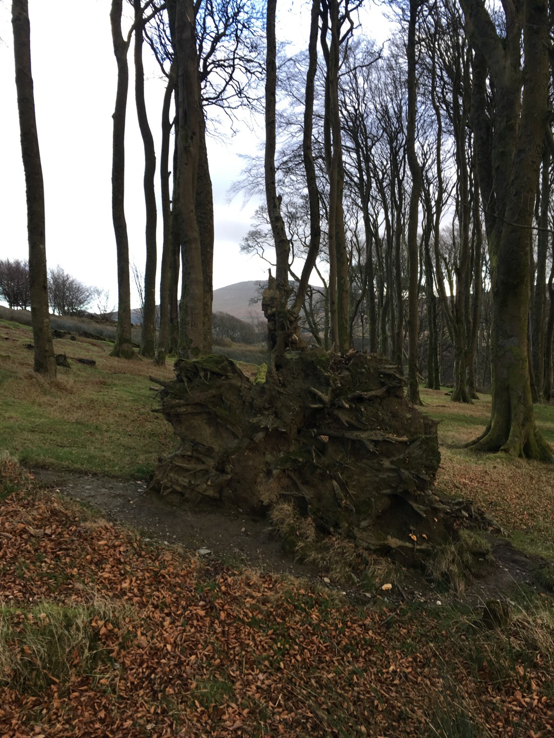
The path turns uphill, and inland over a couple of stiles to a cottage where I took the right turning through a gate and climbed the very steep track over ‘the slabs’.

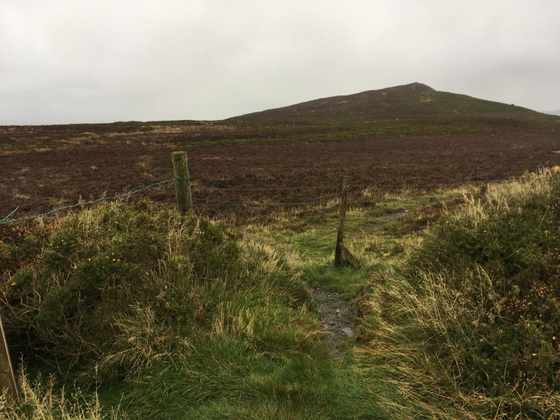
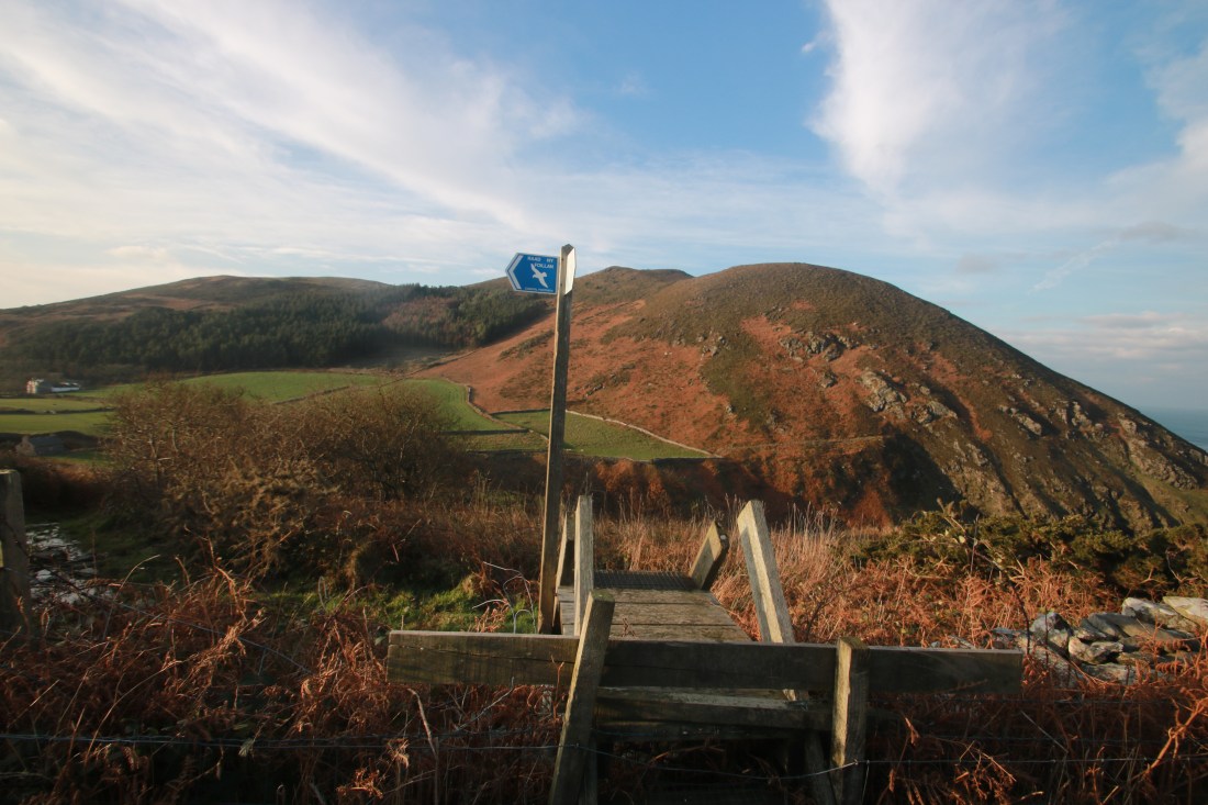
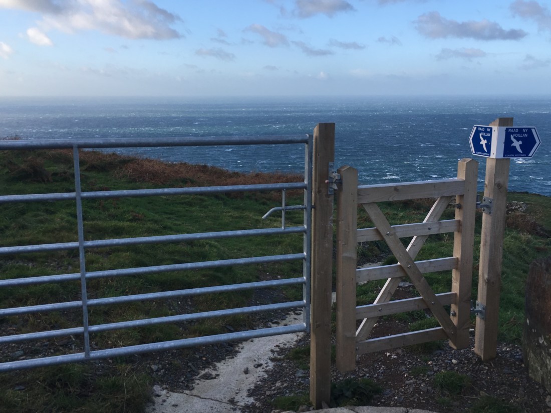
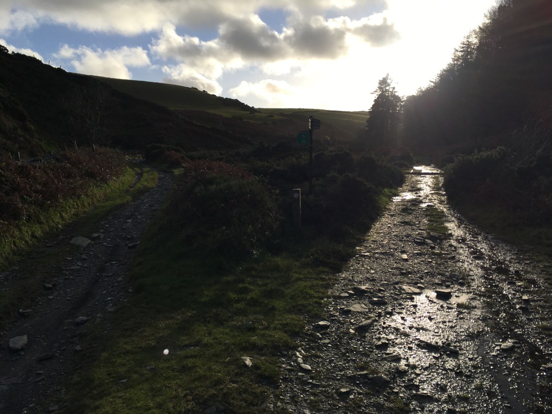
The path became smoother but no less steep until I reached a gate on the right through which I followed the Raad ny Foillan sign.

IMG_1240

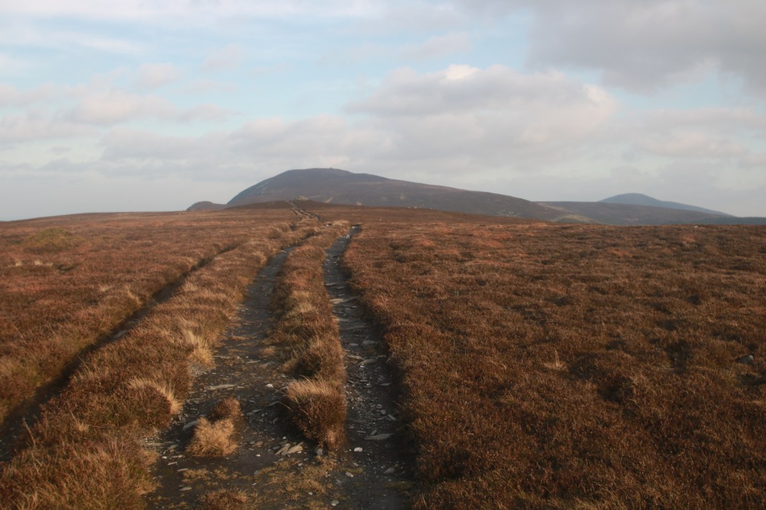
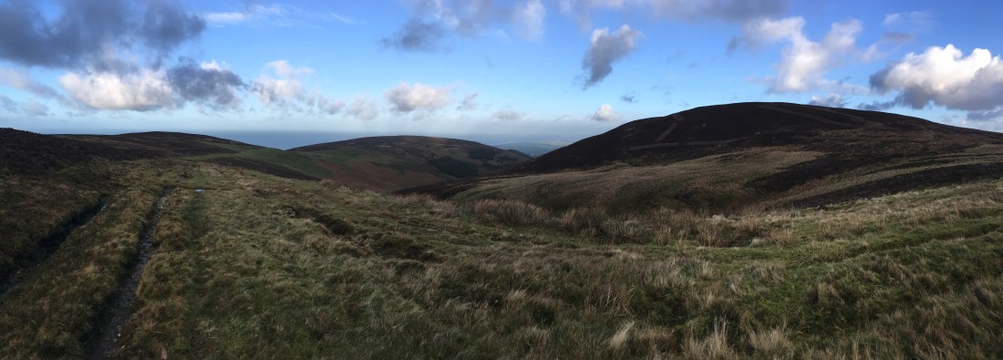
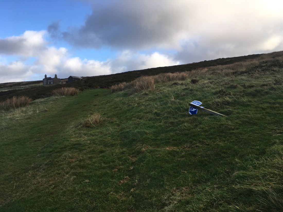
This led onto a superb path which actually lost height as it got nearer to Cronk ny Arrey Laa meaning that my climb was going to be a long one.

IMG_1243IMG_1245IMG_1248IMG_1249

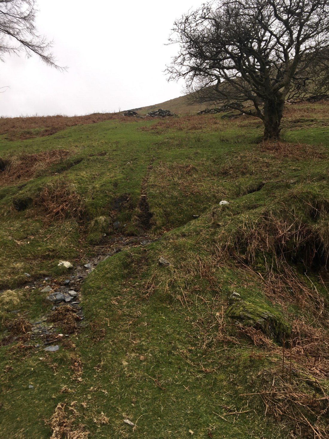
After crossing a stream (Glion ny Goayr) the climb started.

10757609376_IMG_2215

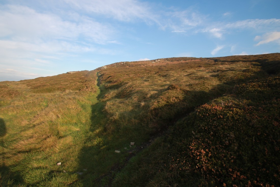
It was steep and relentless climbing up towards Eary Cushlin. Only at the track to the house was there a brief lessening of the gradient before it went up again, still following the Raad ny Foillan signs.

IMG_1250IMG_1252IMG_125710756711568_IMG_2221

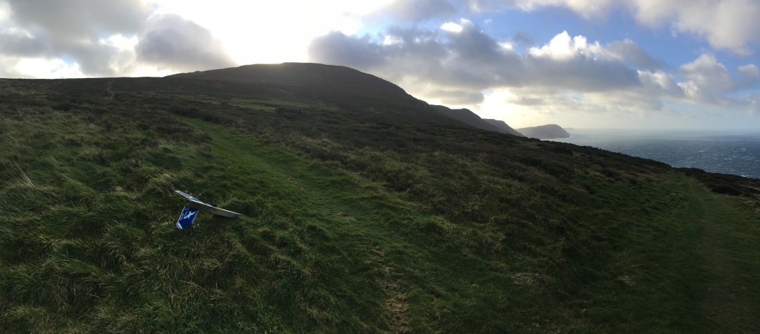
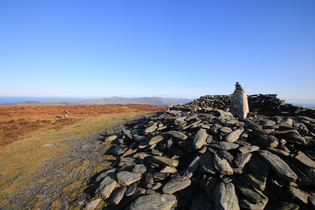
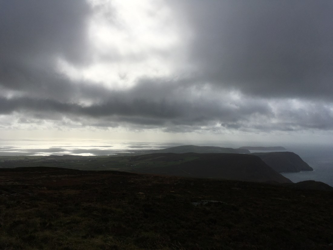
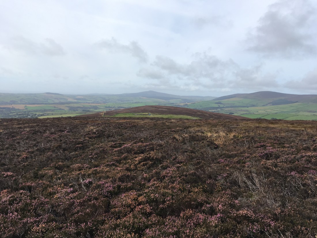
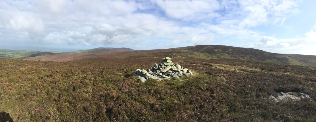
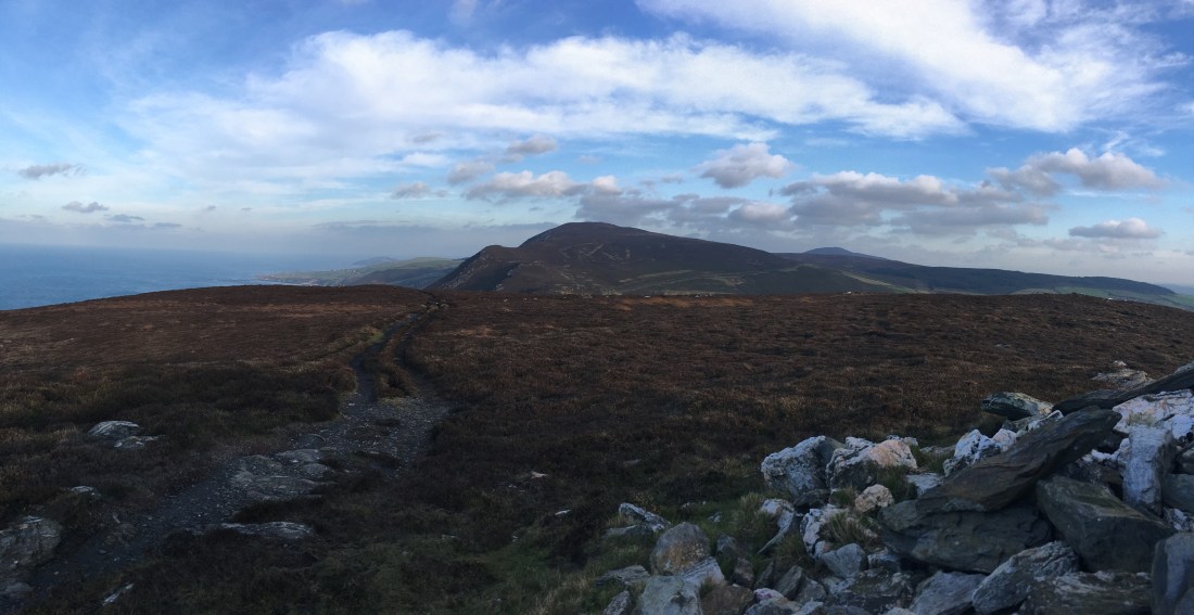
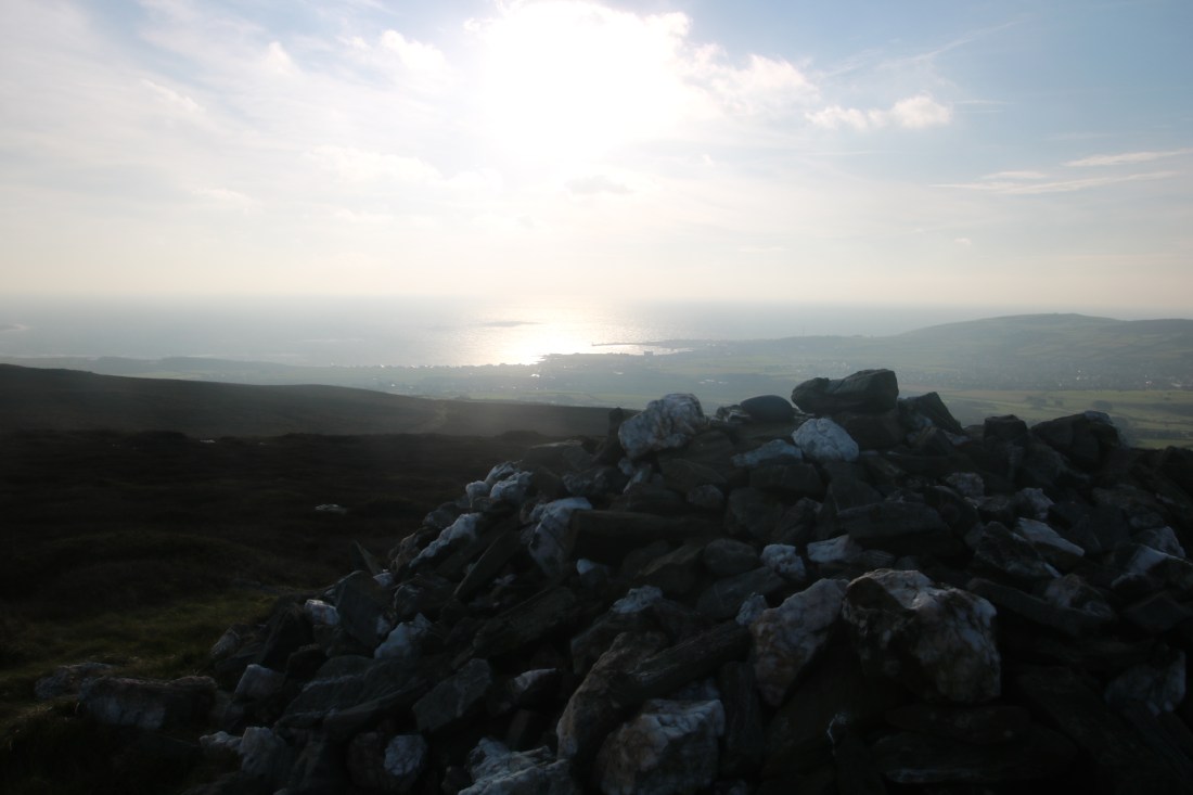
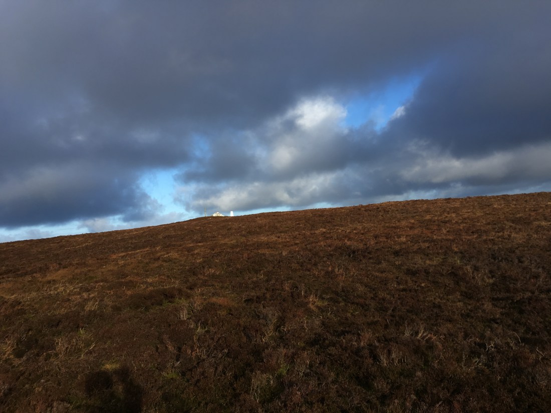
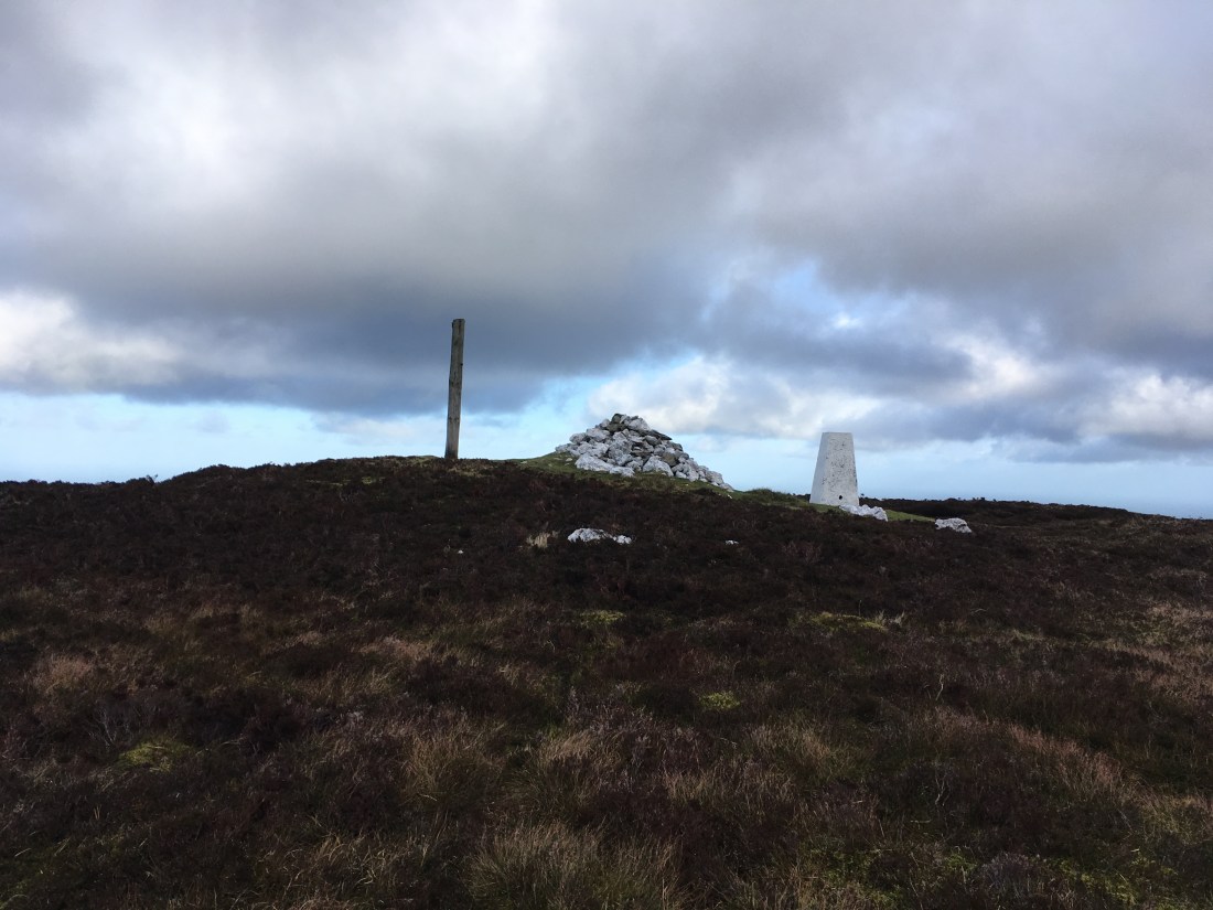
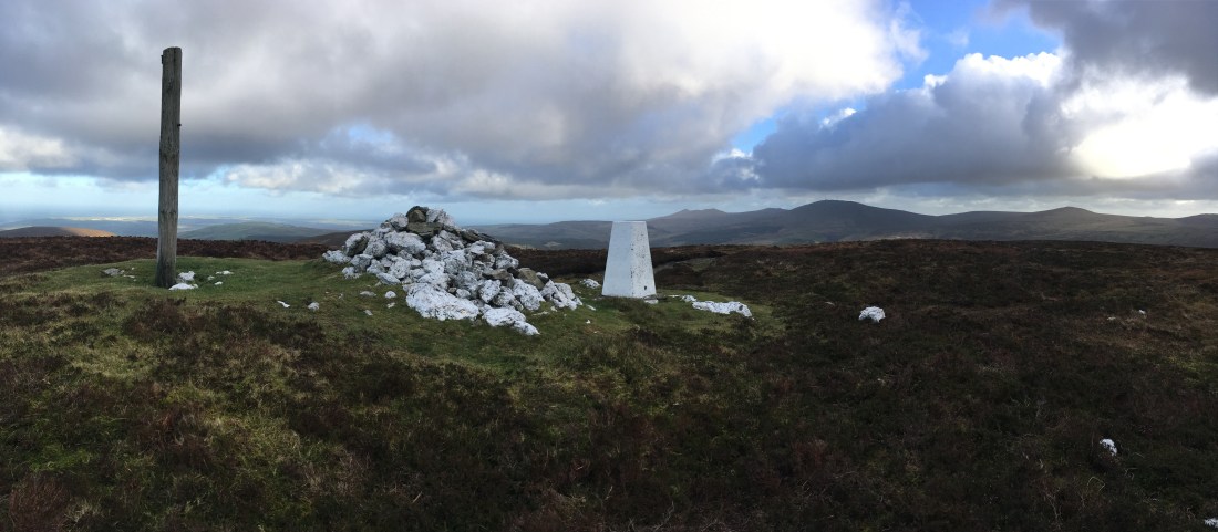
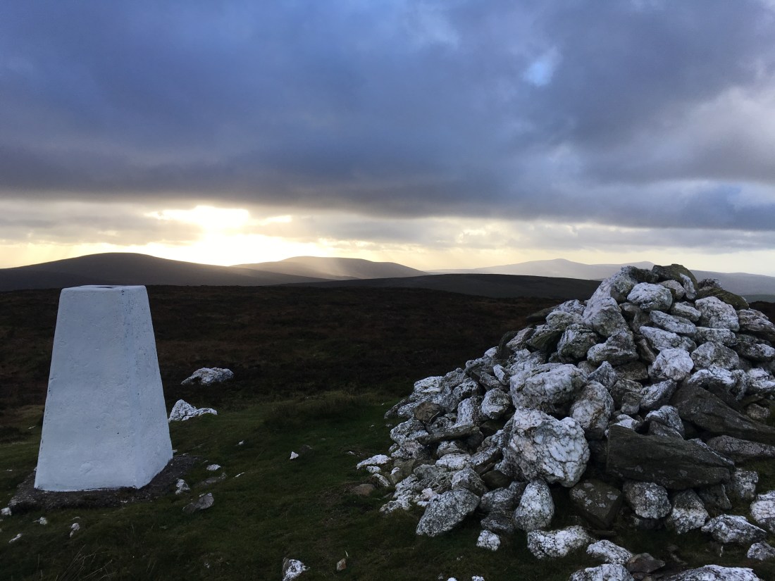
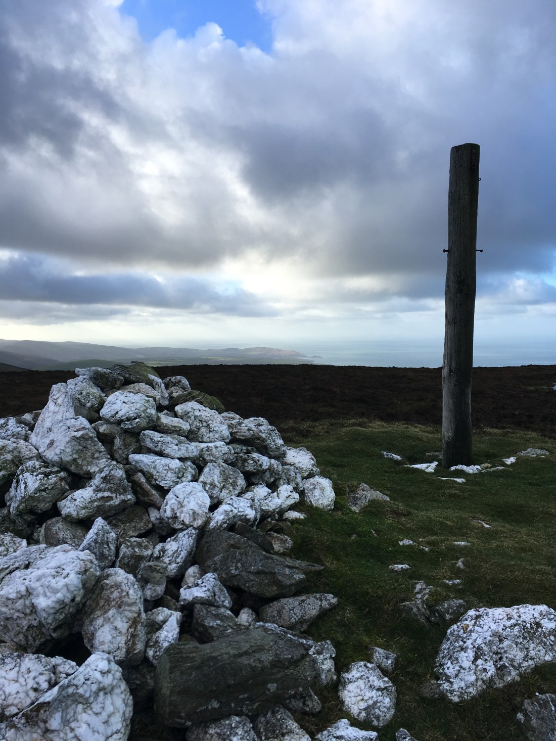
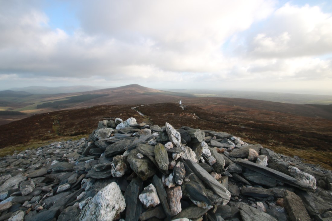
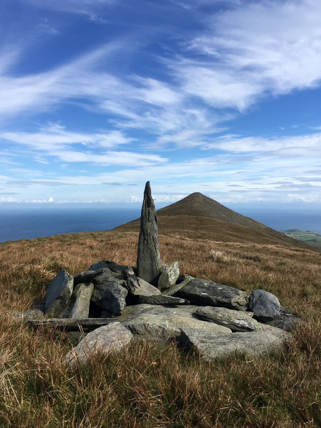
Eventually I emerged at the summit and into the gale. The views were, as always from here, superb in all directions.

10756713392_IMG_222910756901216_IMG_223010756977648_IMG_2250IMG_1259

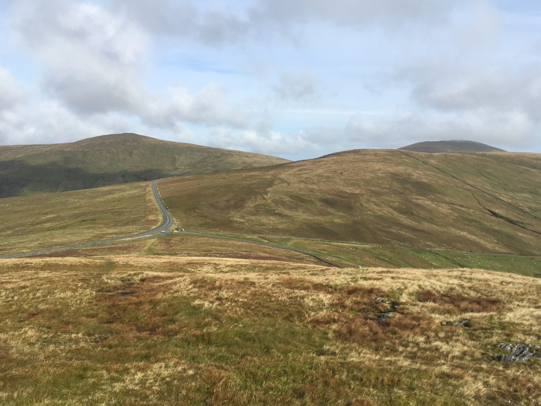
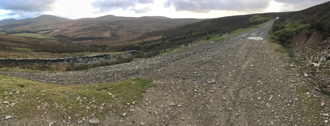
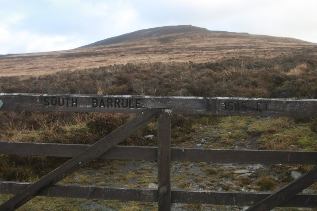
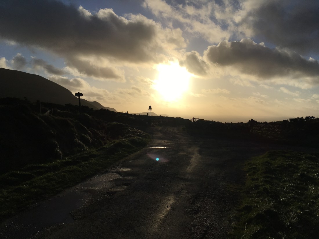
After a short break and refreshment I set off down the main path towards the road. I turned left before the gate to follow the wall along to a smaller gate. On the opposite side of the track is another gate leading onto the moorland named Cronk Fedjag on the map but also known as Lanagour (or something similar). I took the lower path for a change, heading straight across towards Round Table and South Barrule.

I crossed the main road at Round Table and went through the gate which is handily inscribed…..

10757624176_IMG_2267

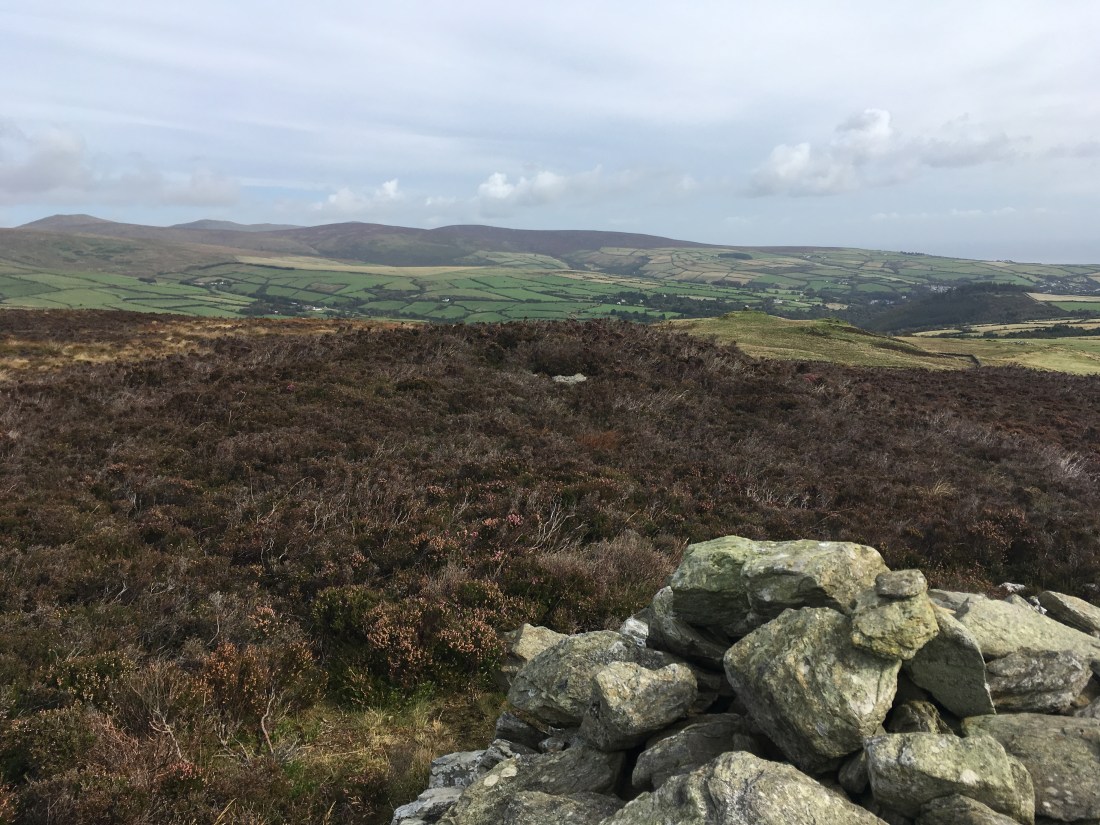
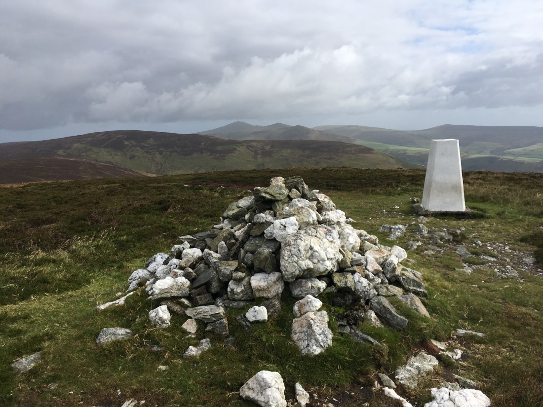
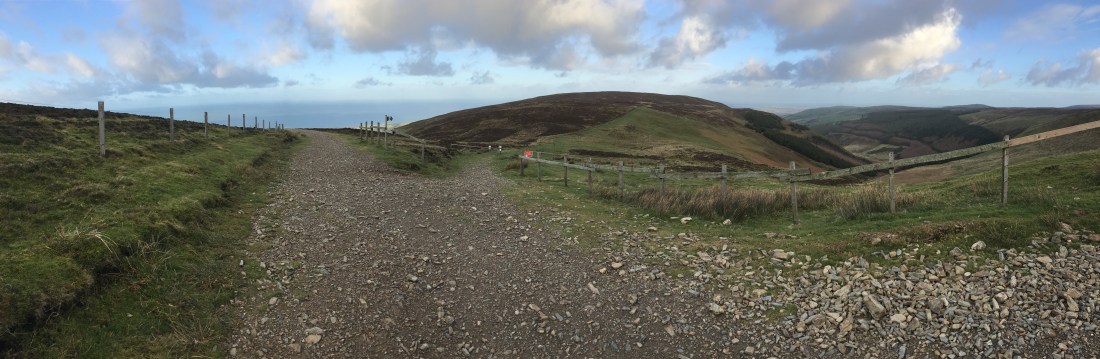
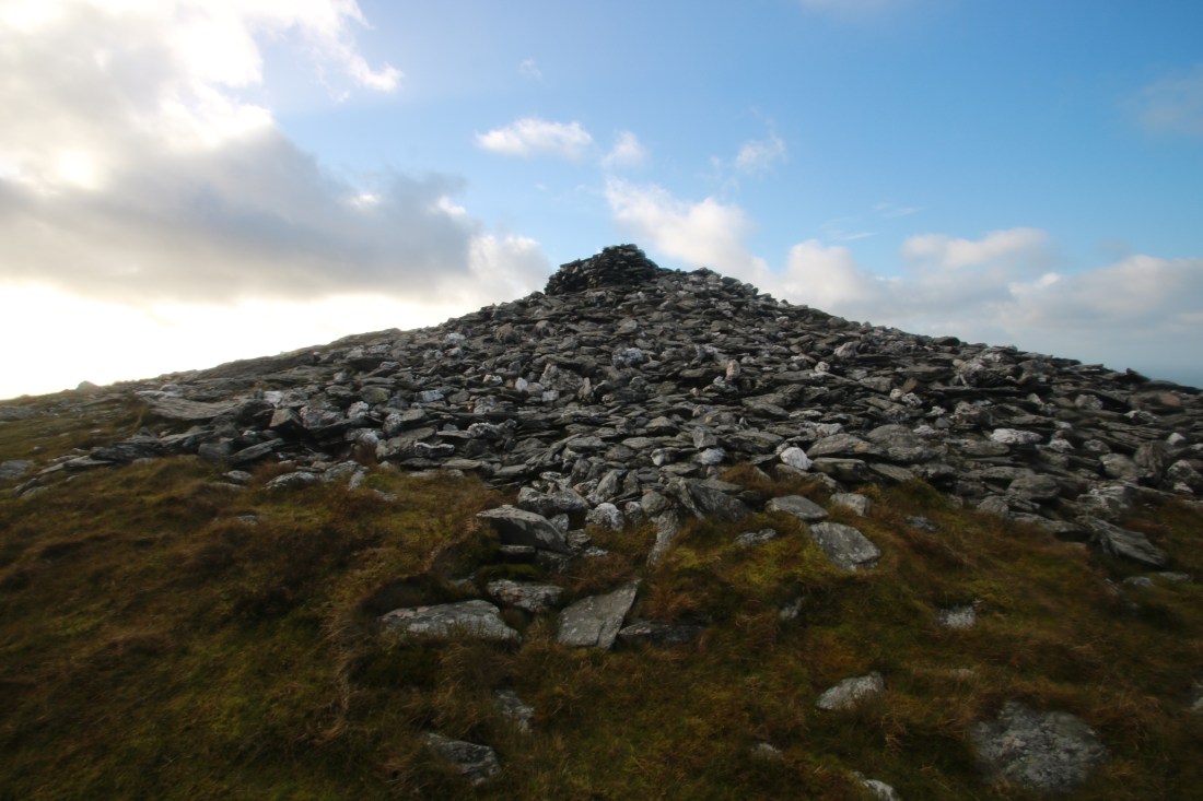
The path from here rises gently across the hill until it reaches the main path from the top of the Whisky Run, It is then a steep climb to the summit, great view all around – back to Cronk ny Arrey Laa, south east to Langness over Cringle reservoir and plantation and north east to Douglas.

IMG_1266IMG_1268IMG_1269

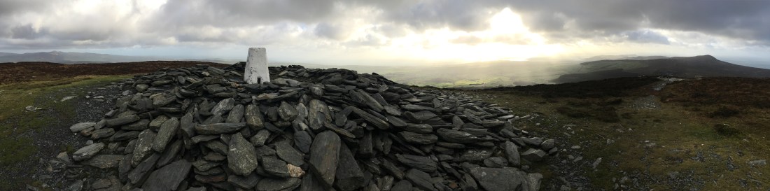
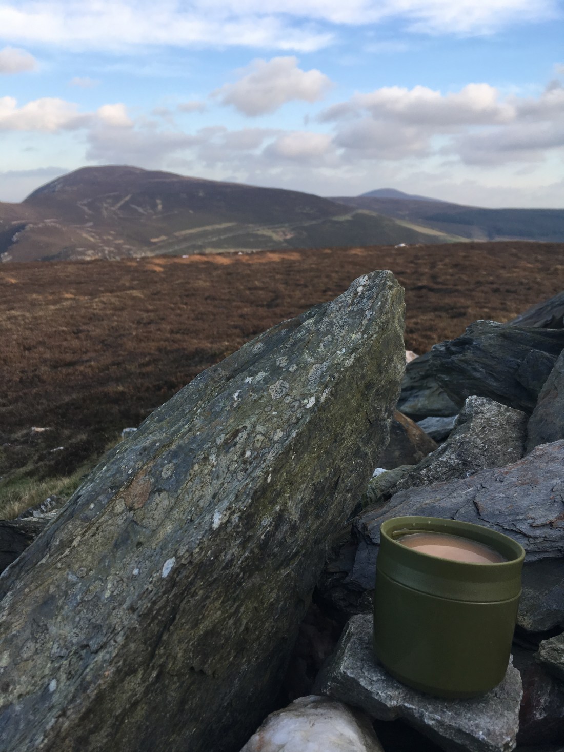
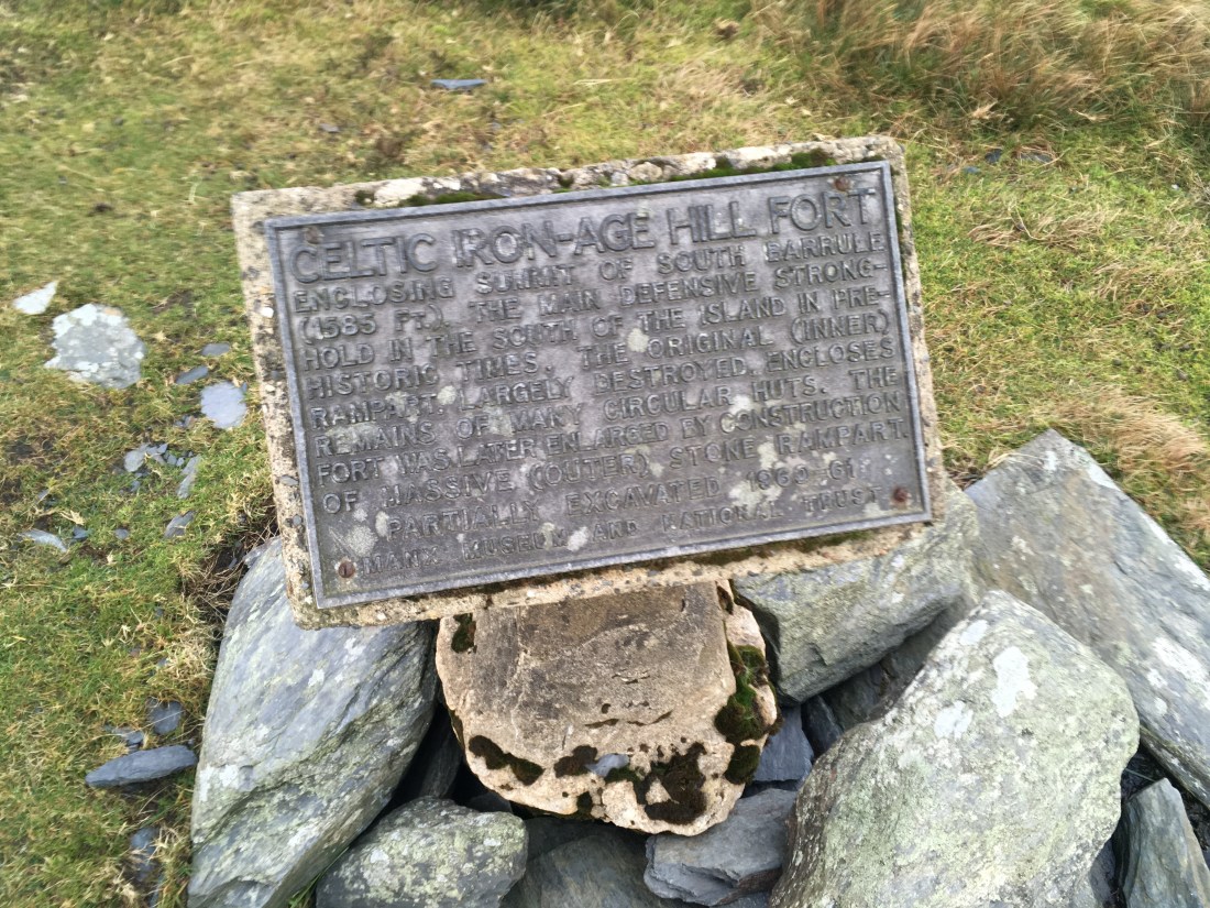
There is a QR code on the trig point, scanning it with my phone provided me with information about the hill fort and even an audio guide if I wanted it.

IMG_1271

The out wall is really obvious and in fact I sheltered below it for a quick brew and something to eat.

IMG_1272IMG_1273IMG_1275

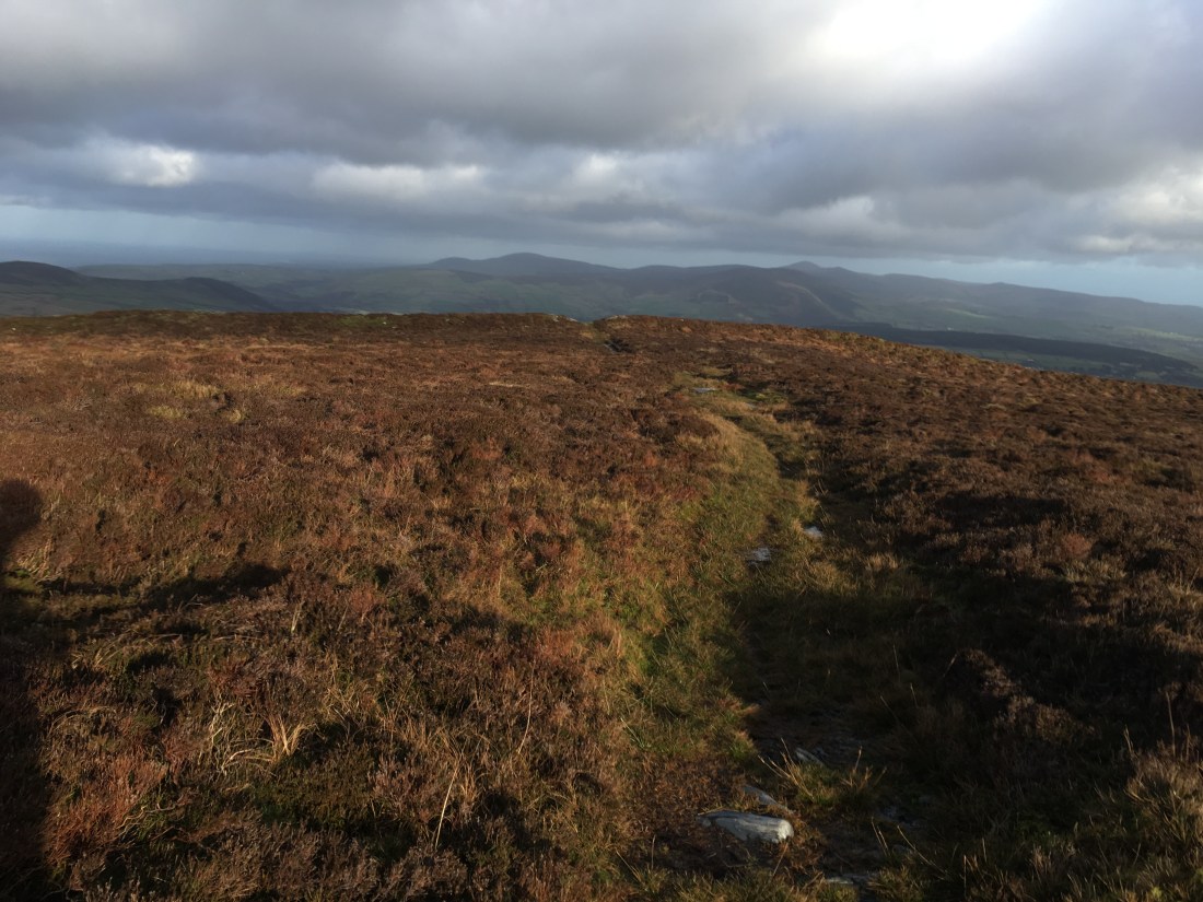
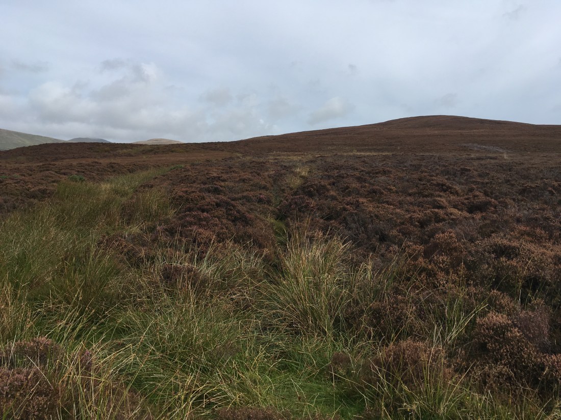
I followed the path NE from the summit and then headed off across the heather aiming straight for Slieau Whallian. This line intersected with another path which led down to the gate at the road.

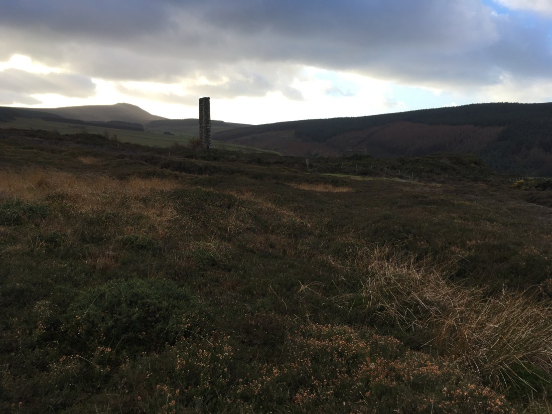
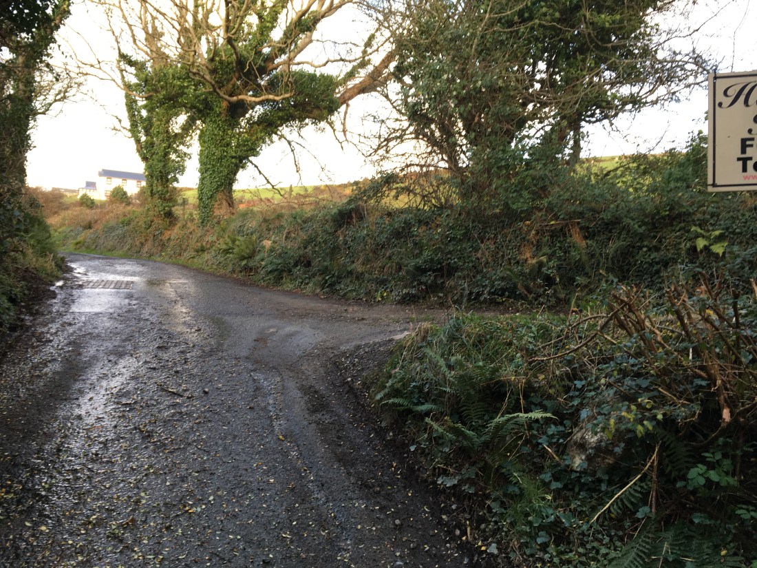
I crossed the road and headed down the lane past the Cross Vein Mine, a fascinating relic of a more industrial age. I can’t help thinking more could be done with these sites, only in Laxey does this industrial heritage seem to be valued.

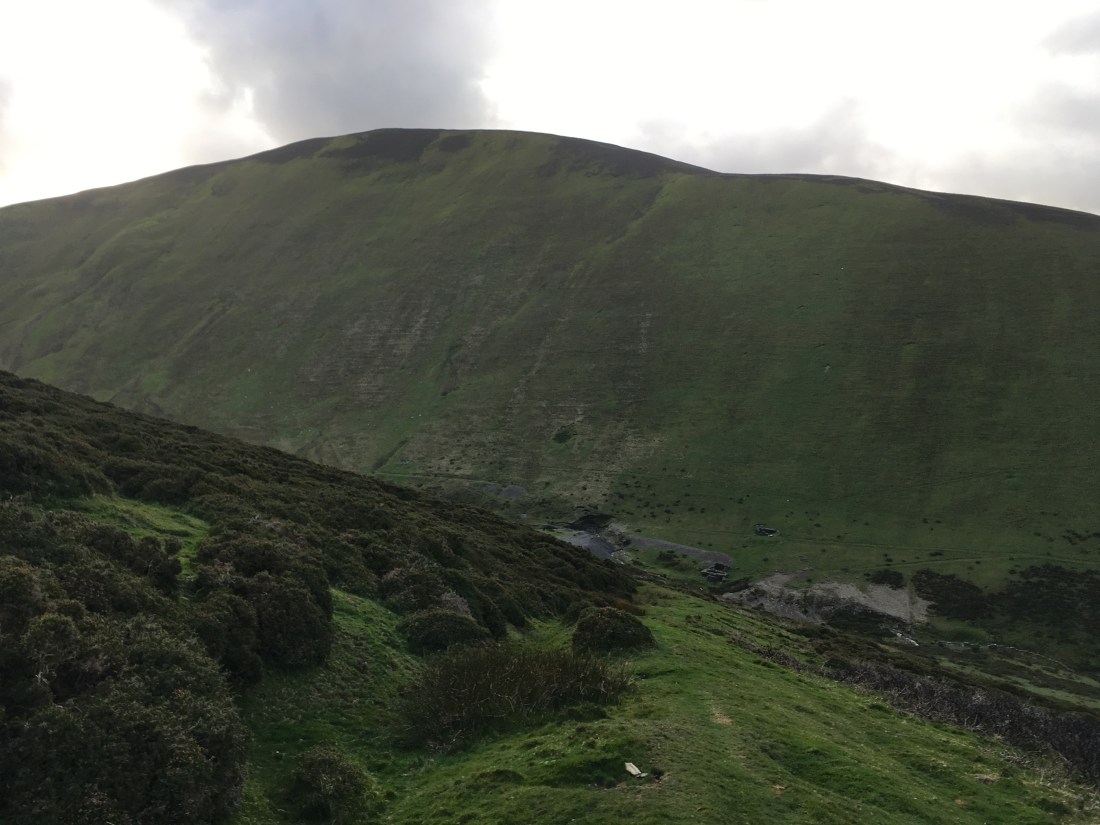
I then turned left down the Glen Rushen road, passing by Beckwith’s mine where the leaning chimney sadly fell a few years ago. The was a good view back to the top of Cronk ny Arrey Laa form here.

IMG_1296

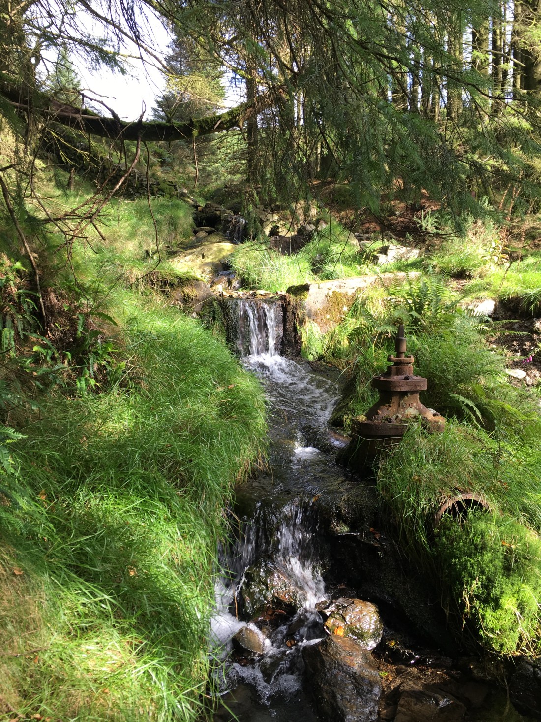
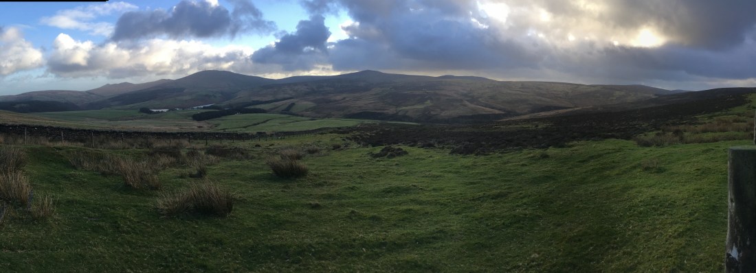
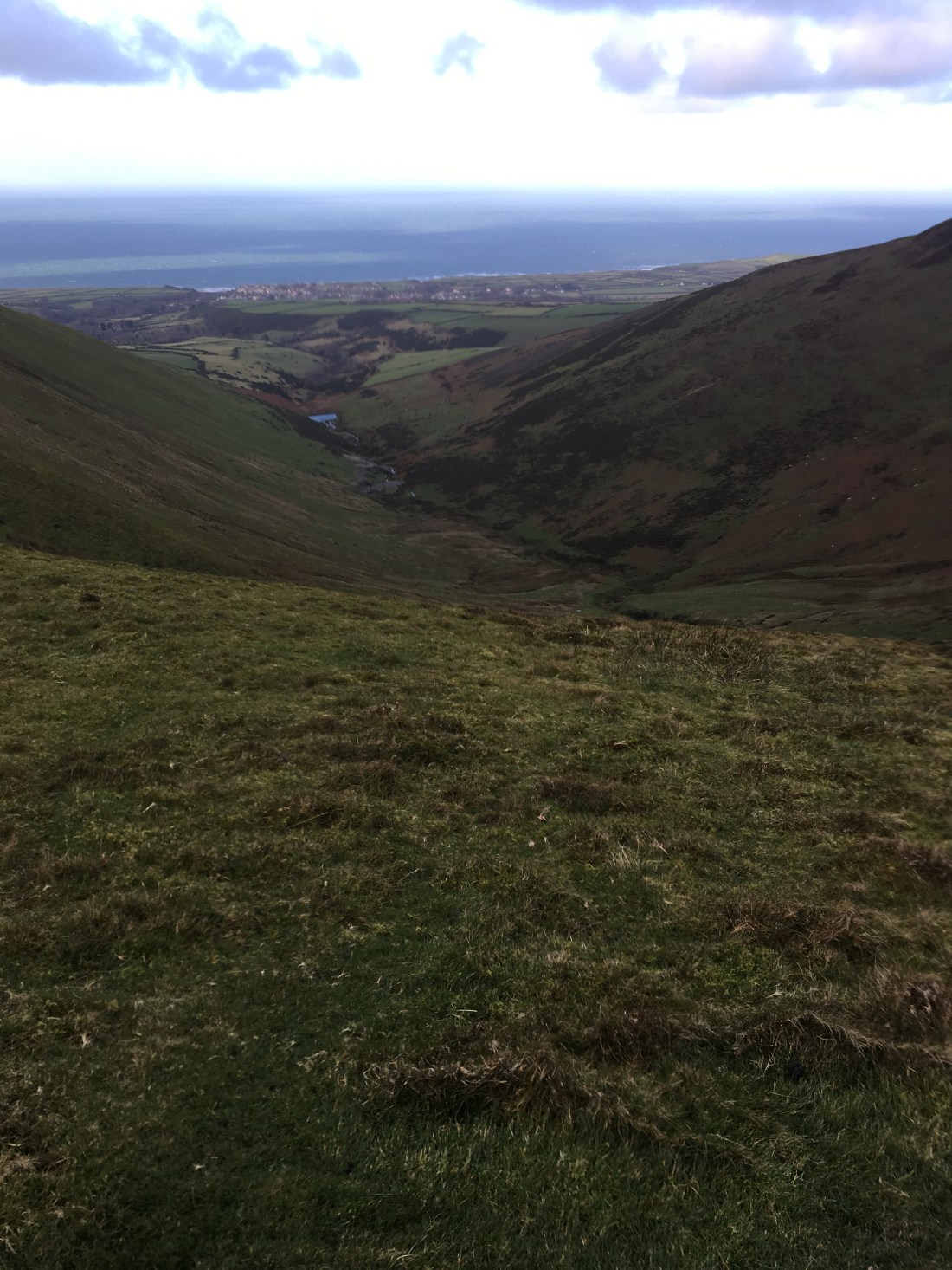
This leads down into Glen Rushen passing what I assume are old miners cottages before reaching the junction where I went left down to the river.

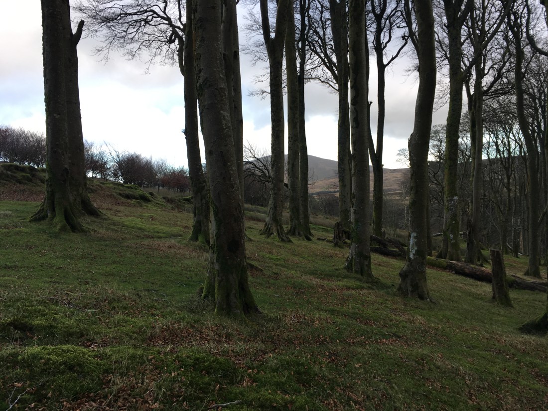
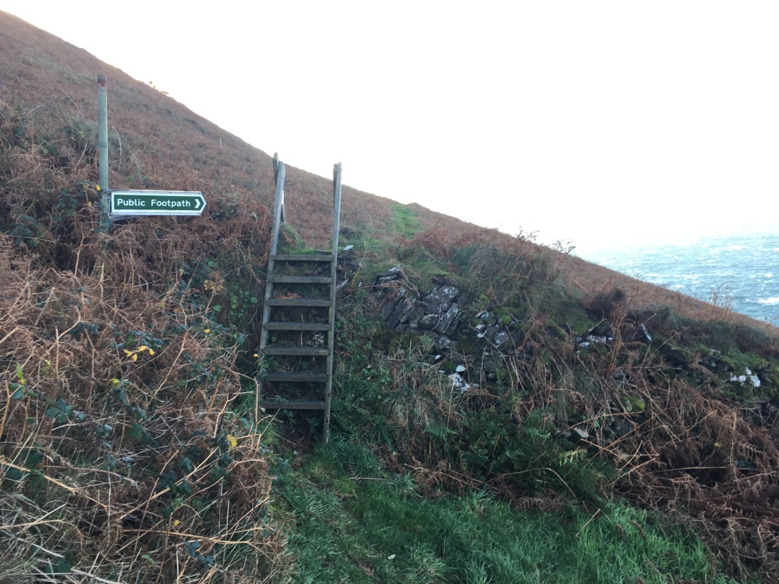
At the next junction I took the right fork which leads to a gate and steps leading up to Creg ny Crock plantation.

IMG_1310IMG_1312IMG_1314IMG_1316

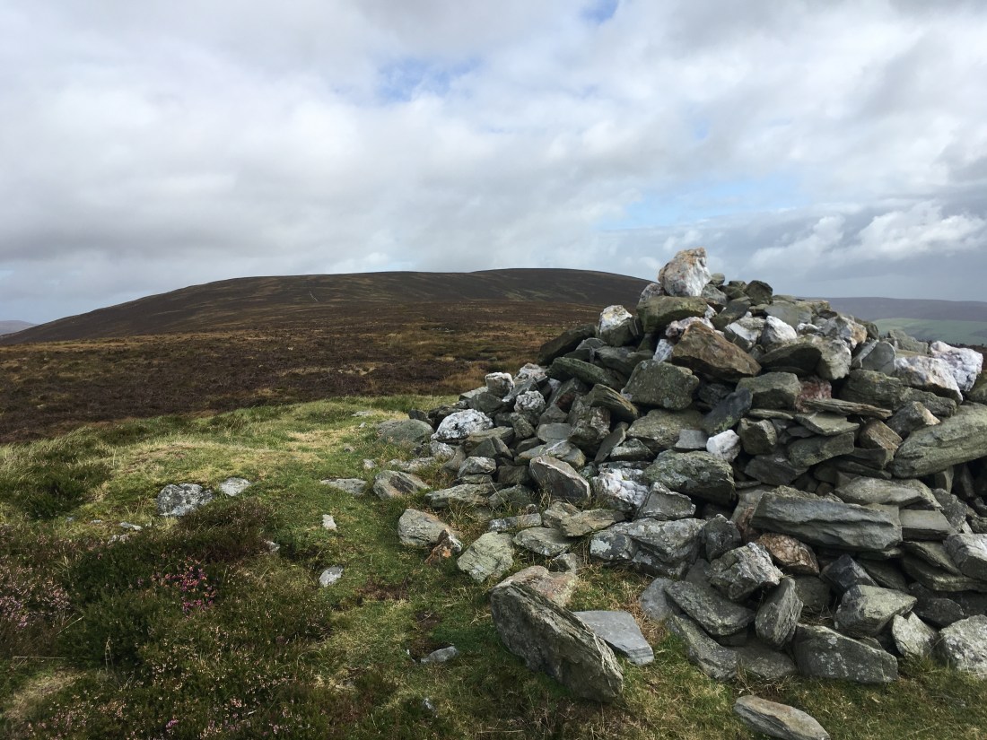
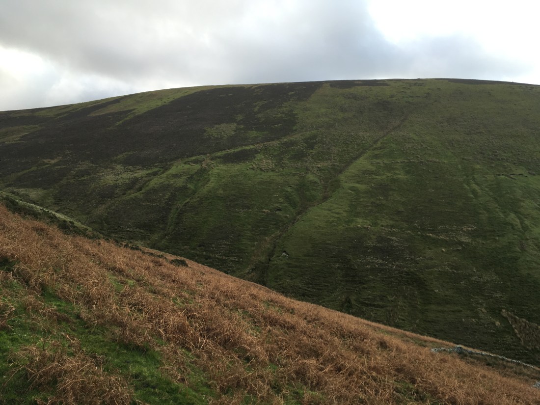
At the top, near the tholtan I should have gone straight on towards the road and then to the Eary Cushlin track but I was tempted along the fire track sharp right at the top of the climb in the thought of going to the top of Dalby Mountain.

Years ago we used to regularly ride this fire track on mountain bikes but it is now choked with gorse. I persisted but wouldn’t recommend it to anyone. With scratched legs I passed a gate and then turned left up a break to another gate and the open moorland of Dalby Mountain, the top of which was marked by a few stones.

I followed the track which had a newly built stile over a barbed wire fence, was passed by a farmer in his tractor who took no notice and reached the road more or less opposite the Eary Cushlin track.

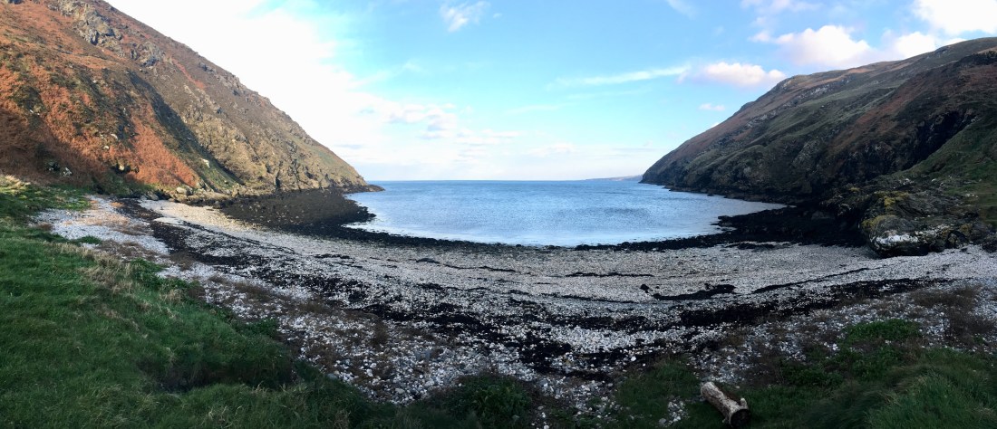
I crossed the road and followed the track to the gate at the far side of Keroodhoo plantation and turned right, back down towards ‘the slabs’, enjoying the spectacular views back to Niarbyl.

IMG_1329

IMG_1330IMG_1331IMG_1332IMG_1333IMG_1337

Rather than go back to White Beach I thought I would follow the track and lane to the road. I reached Niabyl as the afternoon light became spectacular so went back to the headland to enjoy the view before heading home.

IMG_1340IMG_1341IMG_1342IMG_1344

A long and blustery day but an excellent walk of just over 23km and 1400m ascent in 5 hours 30 minutes. Well recommended!

Sartfell and Slieau Freoaghane

IMG_1117

Having climbed both of these hills, in particular Slieau Freoaghane, many times from Brandywell and Kirk Michael I thought I would do something a bit different this time and start from Montpellier Wood on the Druidale road.

Gales and showers were in the forecast as I parked at Montpellier and tired to locate the more northerly of the public rights of way marked on the maps.

IMG_1089

I tried to pick this path up from the ford but in retrospect realise I should have walked up to the tholtan. I followed sheep trods and eventually crossed to the wall and fence where I found the correct path.

Here a stile took me to the space between the wall and fence but soon another returned me to the left of the fence and that led to a broken stile onto the main greenway track running north below today’s two hills.

Views to Snaefell and the North Barrule ridge were excellent and would stay with me for much of the day.

IMG_1103

I passed through the gate on the track and turned immediately left onto the path now closed to vehicular traffic which runs between Slieau Freoaghane and Slieau Dhoo towards Kirk Michael.

IMG_1104

This path is at first rutted badly but the walking improves as do the views over the west coast and Slieau Curn.

IMG_1105

Suddenly the sun came out and the colours all changed.

IMG_1107

At the path junction I took the left turning, the top of the Baltic track down to Kirk Michael.

IMG_1109

After a short distance I turned left over a stile onto the small path heading down into the ‘lost valley’.

This fine path rounds the shoulder of the hill and reveals the most dramatic side of Slieau Freoaghane.

IMG_1116

That hill was for later, however, and I descended to the old mine buildings by the stream in the valley.

This is a fine spot, especially now the hillside is recovering from the motorbike tracks that used to scar it.

Two tracks leave the mines. Previously I have taken the higher one onto the shoulder of Slieau Freoaghane and climbed it that way but today I followed the lower track, contouring above the reservoir (an ideal small scale hydro plant for the farm below surely?) and branched left following the fence and the track shown on the maps.

The path became clearer after passing the first stream and after the second it started to climb up towards the ruin between Freoaghane and Sartfell.

In the past I have gone as far as the ruin (and old mill?) before heading over to Sartfell but today once above the D shaped sheep fold I followed sheep trods down to the stream and picked up the diagonal line visible on the next photo.

IMG_1140

Sartfell always seem like hard work whichever route you take. This one was harder than most so I had a break for tea before climbing into the gales at the top.

The top of Sartfell is a bleak place, bare and stony in places with one part fenced off for no apparent reason.

IMG_1149IMG_1150

The summit is marked by the customary telegraph pole. The views were very fine especially to the north east.

I descended easily to the path just above the ruin, crossed straight over it and followed a faint path towards the summit of Slieau Freoaghane.

IMG_1157IMG_1158

Another break here in the shelter of the cairn and intermittent sunshine gave yet more superb views. This really is one of the best Manx summits.

IMG_1162IMG_1164IMG_1166IMG_1167

The descent north is easy giving a fine view over Slieau Curn and Slieau Dhoon and then back down into the ‘lost valley’.

IMG_1175

IMG_1176

The wind here made it difficult to stand but I was soon on the stone track, temporarily heading south before taking the main track to the left.

IMG_1183

IMG_1184

After crossing the stream the map shows a public right of way turning right of this track back down to Montpellier. It is easy to miss – I certainly did and back tracked to find a stile. There is not footpath sign and once on the other side of the stile no path.

After battling through heather I entered an area of small beach trees (an extension of Montpellier?) and then out of the blue picked up footpath signs. There must be a path here after all!

I soon entered the very fine beachwood and descended back to the Druidale road and the car.

IMG_1194IMG_1196IMG_1197IMG_1200

Another wild day (though it did stay dry) and another fine walk in good rambling country. 11km in 3 hours (quite a lot of ascent on this one – 735m).